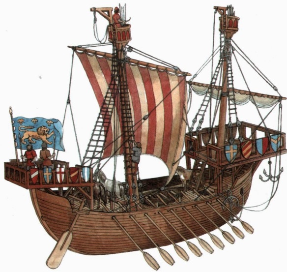
Late 12th Century Northern Cog.
Ships built in the ancient period were too feeble to routinely take to the sea in any but fair weather. Longships—rowed galleys—were the state-of-the-art ships-of-war of the day, but they could not venture far. The classic Mediterranean galley had a freeboard too low to test even a moderate sea, and the oarsmen who filled the narrow, cramped hull forced frequent stops for food and water. The round, or sailing, ship could better manage rough seas, and its small crew and ample storage space gave it greater freedom of movement. But the roundship was difficult to sail, especially upwind, and it was hostage to breezes and currents in a way that the galley was not.
Geographic ignorance and nescient navigational methods also handicapped ancient mariners. There were marvelous, though periodic, scientific advances. In the third century bc astronomers determined that the earth was a round sphere rotating on its axis as it revolved around the sun. About 240 bc Eratosthenes of Alexandria, the most versatile scholar of his day, calculated the size of the planet, overestimating it slightly but establishing the theoretical groundwork that allowed Columbus 1,700 years later to sail west to reach the east. In the second century ad Claudius Ptolemy, the most accurate of the ancient geographers, subdivided the world into fractions of a circle, marking his maps with what he termed lines of latitude and longitude.
Despite these advances, science was of little use to the practical navigator. The outlines of regions, and an entire hemisphere, were yet unmapped. Maps were rare, expensive, and inaccurate, at least for the purposes of navigation. While astronomical devices existed, they were rarely taken to sea. Mariners had to rely primarily on their eyes to render crude judgments of the position of celestial bodies to determine latitude, and had no means, until the late eighteenth century, of ascertaining longitude. At best, captains owned coast pilots—what the ancient Greeks had termed periplus—that contained information on distances between ports, locations where ships could water, prevailing winds and currents, depth of water, and assorted geographic descriptions to aid mariners as they made their way along a coast. At the height of the Roman Empire, some lucky captains may have possessed primitive charts of the Mediterranean. But even after the appearance of functional navigational instruments late in the first millennium ad (the astrolabe and the magnetic compass, imported from the Arabs and the Chinese respectively), most European seafarers sailed or rowed near, if not along, the coast by their wits, relying on years of experience, and praying for the clear skies that allowed them to mark the positions of shore, sun, moon, and stars.
Lack of navigational tools did not prevent open-ocean navigation. Phoenicians and Greeks in the Mediterranean, Arabs in the Indian Ocean, the Irish and Norse in the North Atlantic, and the Chinese in the Pacific all conducted open-sea cruises of great length and difficulty. But the absence of instruments to guide mariners and the primitive state of the shipbuilder’s art combined to limit maritime activity to a season that lasted little more than half the year.
Evidence of the relative unimportance of the sea in the affairs of nations can be seen in the nature of piracy. The pirates of the ancient world, for example the Cretans, Illyrians, and Cilicians, sought their booty ashore, not afloat. As Lionel Casson wrote in his history of seafaring:
The ancient pirate, like his later brethren, chased and boarded merchantmen. But his stock-in-trade was not that; it was slave-running. And attack on the high seas was hit-or-miss: a pirate chief could not tell from the look of an ordinary merchantman plodding along whether it was carrying a load of invaluable silks and spices or cheap noisome goat hides. But a swift swoop on any coastal town was bound to yield, even if the place was too poor for plunder, a catch of human beings, of whom the wealthy could be held for ransom and the rest sold for the going price on the nearest slave block.
Not until after the Arab invasion of the seventh century ad turned the Mediterranean into an embattled frontier between two cultures did the activities of pirates gradually shift from raids against the shore to attacks against shipping, most notably by the corsairs of the Barbary Coast of North Africa. In northern European waters, where commercial development initially lagged behind that of the Mediterranean, piracy remained associated with coastal raiding much longer.
